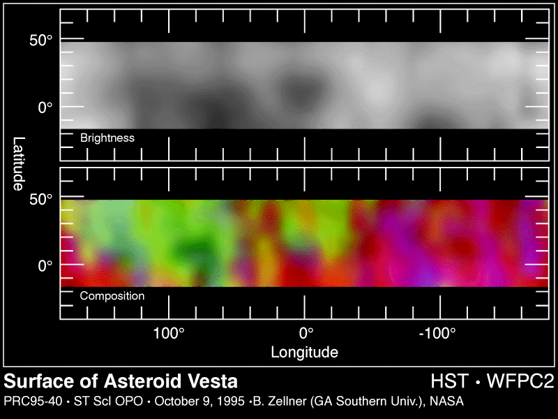
This is about 500 Km in diameter. The top picture is a surface brightness map. The surface markings may represent ancient igneous activity such as lava flows and, in addition, regions where major impacts have stripped away the crust revealing mantle material below the crust.
The bottom map was produced from separate images in blue (439 nm), orange (673 nm), red (953 nm), and near-infrared (1024 nm) light. It shows that Vesta has two distinct hemispheres containing two different types of solidified lava called basalts.